Including Khe Sanh
Western Quang Tri Province kmz
Friday, November 30, 2012
KMZ file for A Shau Valley
Here is the Google Earth kmz file for the A Shau Valley. Only one icon at the moment- more will come.A Shau Valley kmz (4 overlay maps on Google Earth)
 |
| Screen shot of A Shau Valley looking NW |
Thursday, November 29, 2012
More Vietnam Stuff
Various items from the Vietnam War 4D GIS project
 |
| Superimposed picture of Saigon River and wharf district |
 |
| Custom troop icons- original models from the artists at Junior General! |
 |
| Superimposed picture of the US Embassy |
 |
| III Corps showing VC base areas and logistical routes |
 |
| A custom military icon creator I designed in Photoshop |
 |
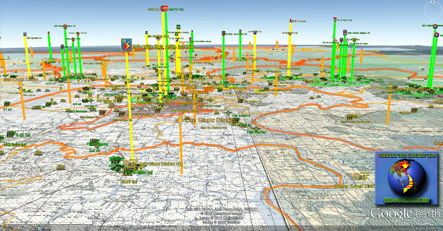
| III Corps showing various allied headquarters (up in the sky) |
 |
| An early version of my Photoshop technique- I've refined it since then, but you get the idea. |
 |
| Custom terrain icons |
Some Vietnam War maps
Welcome to the Digital Military Historian!
Subscribe to:
Comments (Atom)


.jpg)


